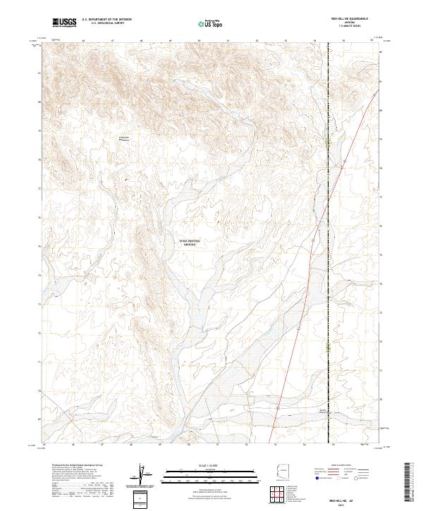
2021 Map of Red Hill NE
USGS Topo · Published 2021About this map
Chocolate Mountains define the northern terrain of this desert landscape, where steep contours give way to the broad alluvial expanse of the Castle Dome Plain in the south. The area is characterized by a complex network of ephemeral drainages, the most prominent being Indian Wash, which winds through the central valley. This 2021 survey reveals a landscape largely shaped by seasonal water flow and the geological transition between upland ranges and lowland basins. The boundary between La Paz Co and Yuma Co cuts vertically across the eastern side of the quadrangle, marking a quiet administrative division in a region dominated by desert scrub and dry washes rather than human settlement.
Find a feature on this map
10 named features on this map. Tap any name to fly to it.
Don’t see what you’re looking for? This feature index may not catch every label — zoom into the map to look around manually.
Map Details
Editions of this 2021 Red Hill NE Map
This is the sole edition of this map. No revisions or reprints were ever made.
Other maps of this area

1934 · Trigo Peaks
USGS Topo · 1:48,000

1939 · Red Hill
USGS Topo · 1:62,500

1939 · Trigo Peaks
USGS Topo · 1:62,500

1942 · Blythe
USGS Topo · 1:250,000

1954 · Salton Sea
USGS Topo · 1:250,000

1954 · Red Hill
USGS Topo · 1:62,500

1954 · Trigo Peaks
USGS Topo · 1:62,500

1955 · Salton Sea
USGS Topo · 1:250,000

1959 · Salton Sea
USGS Topo · 1:250,000
1962 · Livingston Hills
USGS Topo · 1:62,500