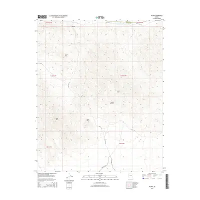
2014 Map of Planet
USGS Topo · Published 2014About this map
The Bill Williams River marks the northern boundary of this desert landscape, tracing the border between Mohave and La Paz counties. The small settlement of Planet is situated near the riverbanks, serving as a historic point of reference in an area defined by significant elevation changes. To the south, the Buckskin Mountains dominate the terrain, featuring landmarks such as Retort Oven and Squaw Peak. This map records a network of primitive desert routes including Swansea Rd and Swansea Mine Rd, which reflect the region's long-standing connection to local mining operations. Rising sharply from the surrounding hills, Planet Peak and Tunnel Peak provide distinct navigational markers for those tracing the development of this arid interior.
Find a feature on this map
17 named features on this map. Tap any name to fly to it.
Don’t see what you’re looking for? This feature index may not catch every label — zoom into the map to look around manually.
Map Details
Editions of this 2014 Planet Map
This is the sole edition of this map. No revisions or reprints were ever made.
Other maps of this area

1911 · Parker
USGS Topo · 1:125,000

1923 · Signal
USGS Topo · 1:250,000

1942 · Signal
USGS Topo · 1:250,000

1943 · Giers Basin
USGS Topo · 1:62,500

1950 · Prescott
USGS Topo · 1:250,000

1954 · Needles
USGS Topo · 1:250,000

1954 · Prescott
USGS Topo · 1:250,000

1956 · Needles
USGS Topo · 1:250,000

1958 · Prescott
USGS Topo · 1:250,000

1959 · Prescott
USGS Topo · 1:250,000