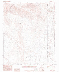
1986 Map of Red Hill NE
USGS Topo · Published 1986About this map
The Yuma Proving Ground dominates the western half of this arid landscape, its boundary cutting through the eastern foothills of the Chocolate Mountains. This 1986 provisional survey documents a region defined by military and conservation land use, where the expansive Castle Dome Plain meets the rugged terrain of the Kofa National Wildlife Refuge. The drainage of Indian Wash snakes through the valley floor, revealing a desert environment modified by selective human activity. Evidence of mineral exploration appears in isolated Prospects and a specific Mine Shaft, while more modern infrastructure is noted via a Radio Tower and a Gravel Pit. A Check Dam along the wash highlights water management efforts in this dry corridor on the border of La Paz and Yuma counties.
Find a feature on this map
13 named features on this map. Tap any name to fly to it.
Don’t see what you’re looking for? This feature index may not catch every label — zoom into the map to look around manually.
Map Details
Editions of this 1986 Red Hill NE Map
This is the sole edition of this map. No revisions or reprints were ever made.
Other maps of this area

1934 · Trigo Peaks
USGS Topo · 1:48,000

1939 · Red Hill
USGS Topo · 1:62,500

1939 · Trigo Peaks
USGS Topo · 1:62,500

1942 · Blythe
USGS Topo · 1:250,000

1954 · Salton Sea
USGS Topo · 1:250,000

1954 · Red Hill
USGS Topo · 1:62,500

1954 · Trigo Peaks
USGS Topo · 1:62,500

1955 · Salton Sea
USGS Topo · 1:250,000

1959 · Salton Sea
USGS Topo · 1:250,000
1962 · Livingston Hills
USGS Topo · 1:62,500