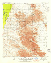
1933 Map of Dome Rock Mts
USGS Topo · Published 1954About this map
The Dome Rock Mountains dominate this 1933 survey, representing a period of intense interest in the mineral wealth of Yuma County. Dozens of mining operations punctuate the terrain, from the Dome Basin Mine in the north to the Cinnabar Mine and Copper Chief Mine further south. The landscape is defined by the vital search for water in an arid environment, marked by sites like La Paz Well, Gonzales Well, and Tule Springs. To the west, the Colorado River forms the boundary between Arizona and California, with the Colorado River Indian Reservation occupying the northwestern corner. The map also records the Old Arroyo Reservation Boundary, providing a clear look at the early 20th-century geopolitical and industrial footprint in this corner of the Sonoran Desert.
Find a feature on this map
38 named features on this map. Tap any name to fly to it.
Don’t see what you’re looking for? This feature index may not catch every label — zoom into the map to look around manually.
Map Details
Editions of this 1933 Dome Rock Mts Map
4 editions found
Other maps of this area

1930 · Linskey
USGS Topo · 1:62,500

1931 · Moon Mtn
USGS Topo · 1:62,500

1932 · Moon Mtn
USGS Topo · 1:62,500

1933 · Cunningham Mtn
USGS Topo · 1:48,000

1934 · Trigo Peaks
USGS Topo · 1:48,000

1939 · Trigo Peaks
USGS Topo · 1:62,500

1940 · Dome Rock Mts
USGS Topo · 1:62,500

1942 · Blythe
USGS Topo · 1:250,000

1942 · MOON MTN
USGS Topo · 1:62,500

1945 · Big Maria Mtns
USGS Topo · 1:62,500