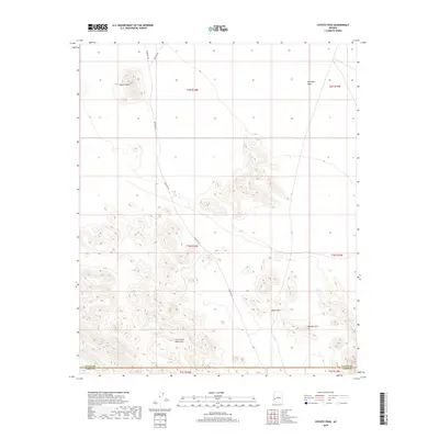
2018 Map of Coyote Peak
USGS Topo · Published 2018About this map
Coyote Peak rises as a prominent landmark above the northern reaches of the Little Horn Mountains in this desert landscape of La Paz County. The terrain is defined by the transition from the broad, relatively flat Ranegras Plain in the northeast to the complex ridgelines and canyons of the south. Significant geological features such as the Royal Arch and Natural Arch are identified within the mountain range, indicating a landscape sculpted by erosion. Transport through this arid corridor is maintained via primitive routes, notably Hovatter Rd and Vicksburg Rd, which navigate the foothills and desert floor. Drainage for the region is primarily captured by the south-trending Cementosa Wash, which cuts through the southwestern section of the range. The mapping highlights the intersection of several townships, including t1n r14w and t1n r13w, showcasing the land division system within this remote part of Arizona.
Find a feature on this map
15 named features on this map. Tap any name to fly to it.
Don’t see what you’re looking for? This feature index may not catch every label — zoom into the map to look around manually.
Map Details
Editions of this 2018 Coyote Peak Map
This is the sole edition of this map. No revisions or reprints were ever made.
Other maps of this area

1942 · Vicksburg
USGS Topo · 1:250,000

1954 · Phoenix
USGS Topo · 1:250,000

1957 · Phoenix
USGS Topo · 1:250,000

1958 · Phoenix
USGS Topo · 1:250,000

1960 · Phoenix
USGS Topo · 1:250,000

1961 · Hope
USGS Topo · 1:62,500

1962 · Little Horn Mts
USGS Topo · 1:62,500

1962 · Kofa Butte
USGS Topo · 1:62,500

1962 · Vicksburg
USGS Topo · 1:62,500

1969 · Phoenix
USGS Topo · 1:250,000