
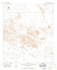
1962 Map of Little Horn Mts
USGS Topo · Published 1963About this map
Little Horn Mountains dominate this arid landscape, where the shifting desert topography meets mid-century military and conservation efforts. To the south, the vast Yuma Test Station indicates the region's importance for desert-based ordnance and equipment testing during the early 1960s. This military presence shares the landscape with the Kofa Game Range to the northwest, a refuge established for the protection of desert bighorn sheep. Natural water sources are scarce, marked by isolated points like Cementosa Tanks and Soldiers Tank, which were vital for travel across the Ranegras Plain. The Oakland Mine sits tucked within the western slopes, a remnant of the prospecting history that preceded the mid-century institutional use of the land. Transportation is defined by a network of unimproved routes, including Hovatter Road and various Jeep Trails, winding through Deadman Valley.
Find a feature on this map
21 named features on this map. Tap any name to fly to it.
Don’t see what you’re looking for? This feature index may not catch every label — zoom into the map to look around manually.
Map Details
Editions of this 1962 Little Horn Mts Map
2 editions found
Other maps of this area

1927 · Hyder
USGS Topo · 1:62,500

1930 · Hyder
USGS Topo · 1:62,500

1942 · Vicksburg
USGS Topo · 1:250,000

1954 · Phoenix
USGS Topo · 1:250,000

1957 · Phoenix
USGS Topo · 1:250,000

1958 · Phoenix
USGS Topo · 1:250,000

1960 · Phoenix
USGS Topo · 1:250,000

1961 · Hope
USGS Topo · 1:62,500

1961 · Lone Mountain
USGS Topo · 1:62,500

1962 · Kofa Butte
USGS Topo · 1:62,500