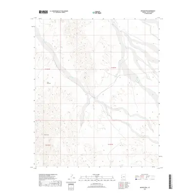
2018 Map of Mohave Peak
USGS Topo · Published 2018About this map
Mohave Peak dominates the southern reaches of this arid landscape in La Paz County, rising above the southeastern foothills of the Trigo Mountains. The terrain is defined by a complex network of ephemeral drainages, most notably Mohave Wash and Gould Wash, which carve wide paths through the desert floor. This 2018 survey illustrates the characteristic alluvial patterns of the region, where seasonal waters move from the higher elevations of the Trigo range toward the surrounding basins. The map provides a precise look at the land's topographical structure, showing the intricate contouring of the ridges and the broad, braided channels of the washes that dictate the movement of water and travel through this part of the Arizona desert.
Find a feature on this map
8 named features on this map. Tap any name to fly to it.
Don’t see what you’re looking for? This feature index may not catch every label — zoom into the map to look around manually.
Map Details
Editions of this 2018 Mohave Peak Map
This is the sole edition of this map. No revisions or reprints were ever made.
Other maps of this area

1934 · Trigo Peaks
USGS Topo · 1:48,000

1939 · Red Hill
USGS Topo · 1:62,500

1939 · Trigo Peaks
USGS Topo · 1:62,500

1942 · Blythe
USGS Topo · 1:250,000

1945 · Cibola
USGS Topo · 1:62,500

1945 · Picacho
USGS Topo · 1:62,500

1951 · Picacho
USGS Topo · 1:62,500

1951 · Cibola
USGS Topo · 1:62,500

1952 · Mule Wash
USGS Topo · 1:24,000

1954 · Salton Sea
USGS Topo · 1:250,000