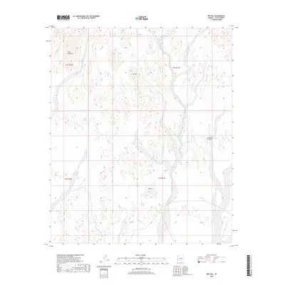
2018 Map of Red Hill
USGS Topo · Published 2018About this map
The Trigo Mountains and Chocolate Mountains dominate this high-desert landscape in La Paz County, where intricate drainage patterns define the arid terrain. The map reveals a complex network of seasonal watercourses, including the prominent McAllister Wash and Yuma Wash, which carve through the volcanic and sedimentary formations. Prominent peaks such as Trip Mtn and the namesake Red Hill provide clear navigational landmarks within the vast, uninhabited stretches of the Sonoran Desert. This 2018 survey serves as a precise record of the landforms and dry-wash geography before further natural erosion or modern land-use changes alter these remote mountain ranges. It is particularly useful for understanding the physical barriers and natural corridors that have historically dictated travel and survival in this corner of Arizona.
Find a feature on this map
10 named features on this map. Tap any name to fly to it.
Don’t see what you’re looking for? This feature index may not catch every label — zoom into the map to look around manually.
Map Details
Editions of this 2018 Red Hill Map
This is the sole edition of this map. No revisions or reprints were ever made.
Other maps of this area

1934 · Trigo Peaks
USGS Topo · 1:48,000

1939 · Red Hill
USGS Topo · 1:62,500

1939 · Trigo Peaks
USGS Topo · 1:62,500

1942 · Blythe
USGS Topo · 1:250,000

1945 · Cibola
USGS Topo · 1:62,500

1945 · Picacho
USGS Topo · 1:62,500

1951 · Picacho
USGS Topo · 1:62,500

1951 · Cibola
USGS Topo · 1:62,500

1954 · Salton Sea
USGS Topo · 1:250,000

1954 · Red Hill
USGS Topo · 1:62,500