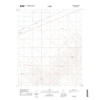
2018 Map of Socorro Peak
USGS Topo · Published 2018About this map
Socorro Peak rises as the central landmark of this arid landscape in La Paz County, where the desert floor meets the southern reaches of the Harquahala Mountains. The settlement of Love sits along the northern rail corridor, serving as a rare point of habitation in a region defined more by its rugged topography and mining history than by urban growth. Early 21st-century infrastructure is sparse, characterized by primitive routes like Hidden Treasure Mine Rd and Urea Ranch Rd that snake through the basins. The passage through Tenahatchipi Pass provides a natural conduit between the mountain ranges, highlighting the historical transit patterns required to navigate this portion of the Arizona desert. This 2018 survey illustrates the persistent isolation of the area, where land is still primarily organized by public land survey townships like t6n r12w.
Find a feature on this map
11 named features on this map. Tap any name to fly to it.
Don’t see what you’re looking for? This feature index may not catch every label — zoom into the map to look around manually.
Map Details
Editions of this 2018 Socorro Peak Map
This is the sole edition of this map. No revisions or reprints were ever made.
Other maps of this area

1942 · Vicksburg
USGS Topo · 1:250,000

1954 · Phoenix
USGS Topo · 1:250,000

1957 · Phoenix
USGS Topo · 1:250,000

1958 · Phoenix
USGS Topo · 1:250,000

1960 · Phoenix
USGS Topo · 1:250,000

1961 · Salome
USGS Topo · 1:62,500

1961 · Hope
USGS Topo · 1:62,500

1961 · Lone Mountain
USGS Topo · 1:62,500

1961 · Gladden
USGS Topo · 1:62,500

1969 · Phoenix
USGS Topo · 1:250,000