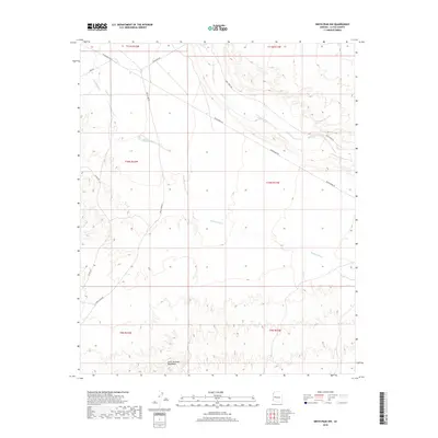
2018 Map of Smith Peak NW
USGS Topo · Published 2018About this map
The Little Buckskin Mountains dominate the southern portion of this landscape in La Paz County, Arizona. This desert terrain is defined by a network of drainage channels including Bullard Wash and Date Creek, which wind through the arid topography. The map illustrates a crossroads of regional desert transit, where Wickenburg Rd and Date Creek Rd intersect. These routes, along with Alamo Rd and Palmerita Rd, provide the primary access to this sparsely populated region. The survey details the exact path of Date Cr as it traverses the northeast, offering a precise look at the hydrology and relief of the area during the late 2010s. The arrangement of section lines and township boundaries, such as t10n r11w, highlights the geometric grid imposed over the natural mountain and wash formations.
Find a feature on this map
16 named features on this map. Tap any name to fly to it.
Don’t see what you’re looking for? This feature index may not catch every label — zoom into the map to look around manually.
Map Details
Editions of this 2018 Smith Peak NW Map
This is the sole edition of this map. No revisions or reprints were ever made.
Other maps of this area

1923 · Signal
USGS Topo · 1:250,000

1942 · Signal
USGS Topo · 1:250,000

1950 · Prescott
USGS Topo · 1:250,000

1954 · Prescott
USGS Topo · 1:250,000

1958 · Prescott
USGS Topo · 1:250,000

1959 · Prescott
USGS Topo · 1:250,000

1960 · Prescott
USGS Topo · 1:250,000

1965 · Prescott
USGS Topo · 1:250,000

1966 · Ives Peak
USGS Topo · 1:62,500

1966 · Artillery Peak
USGS Topo · 1:62,500