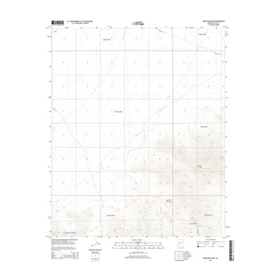
2014 Map of Harcuvar Peak
USGS Topo · Published 2014About this map
The Harcuvar Mountains dominate this arid Arizona landscape, rising sharply above the desert floor and culminating at the prominent Harcuvar Peak. This high-desert terrain is characterized by steep elevation changes and distinct geological formations, including the Granite Wash Mountains visible in the southwestern quadrant. The map documents a sparsely populated region where navigation is defined by rugged corridors like Cottonwood Pass and established routes such as Tank Pass Rd. Infrastructure in this remote area is primarily utilitarian, as seen with Powerline Rd cutting across the northern reaches, illustrating how modern utility corridors often follow the path of least resistance through the desert basins bordering these mountain ranges.
Find a feature on this map
13 named features on this map. Tap any name to fly to it.
Don’t see what you’re looking for? This feature index may not catch every label — zoom into the map to look around manually.
Map Details
Editions of this 2014 Harcuvar Peak Map
This is the sole edition of this map. No revisions or reprints were ever made.
Other maps of this area

1923 · Signal
USGS Topo · 1:250,000

1942 · Signal
USGS Topo · 1:250,000

1942 · Vicksburg
USGS Topo · 1:250,000

1950 · Prescott
USGS Topo · 1:250,000

1954 · Prescott
USGS Topo · 1:250,000

1954 · Phoenix
USGS Topo · 1:250,000

1957 · Phoenix
USGS Topo · 1:250,000

1958 · Prescott
USGS Topo · 1:250,000

1958 · Phoenix
USGS Topo · 1:250,000

1959 · Prescott
USGS Topo · 1:250,000