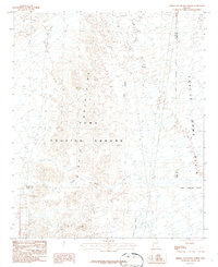
1986 Map of Middle Mountains North
USGS Topo · Published 1986About this map
The Middle Mountains dominate this 1980s landscape, marking a rugged terrain used extensively for military operations and resource exploration. Much of the territory falls within the Yuma Proving Ground, where the desert floor is etched with the drainage of Indian Wash, Los Angeles Wash, and Castle Dome Wash. Evidence of man-made water management is visible through a series of Check Dams situated along the lower slopes leading toward the Castle Dome Plain.
Find a feature on this map
20 named features on this map. Tap any name to fly to it.
Don’t see what you’re looking for? This feature index may not catch every label — zoom into the map to look around manually.
Map Details
Editions of this 1986 Middle Mountains North Map
This is the sole edition of this map. No revisions or reprints were ever made.
Other maps of this area

1929 · Laguna
USGS Topo · 1:62,500

1939 · Red Hill
USGS Topo · 1:62,500

1942 · Yuma
USGS Topo · 1:250,000

1942 · Blythe
USGS Topo · 1:250,000

1943 · Laguna
USGS Topo · 1:62,500

1954 · El Centro
USGS Topo · 1:250,000

1954 · Salton Sea
USGS Topo · 1:250,000

1954 · Red Hill
USGS Topo · 1:62,500

1955 · Salton Sea
USGS Topo · 1:250,000

1955 · El Centro
USGS Topo · 1:250,000