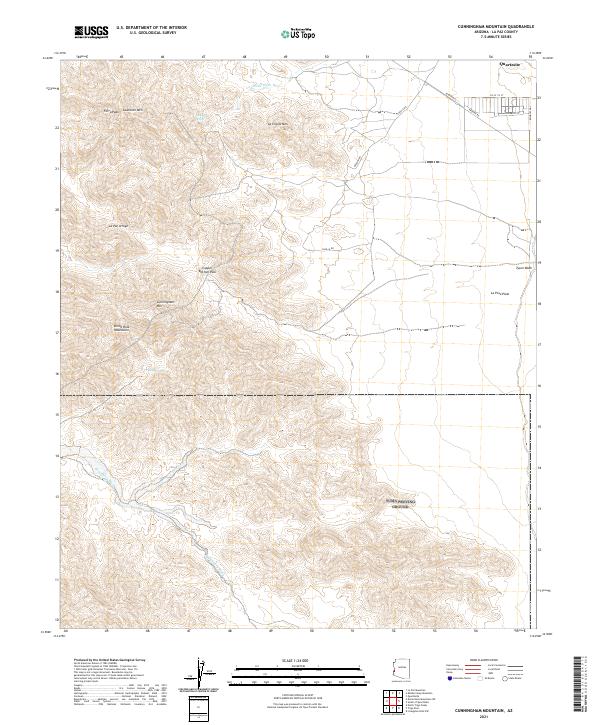
2021 Map of Cunningham Mountain
USGS Topo · Published 2021About this map
The Dome Rock Mountains dominate this arid landscape in La Paz County, Arizona, where high desert peaks meet wide alluvial plains. The topography is defined by significant elevations like Cunningham Mtn and Ferra Peak, separated from La Cholla Mtn by the strategic Copper Bottom Pass. Water, though ephemeral, has carved distinct drainage patterns across the terrain, visible in the winding courses of Ehrenberg Wash, La Cholla Wash, and Tyson Wash.
Find a feature on this map
25 named features on this map. Tap any name to fly to it.
Don’t see what you’re looking for? This feature index may not catch every label — zoom into the map to look around manually.
Map Details
Editions of this 2021 Cunningham Mountain Map
This is the sole edition of this map. No revisions or reprints were ever made.
Other maps of this area

1933 · Cunningham Mtn
USGS Topo · 1:48,000

1934 · Trigo Peaks
USGS Topo · 1:48,000

1939 · Trigo Peaks
USGS Topo · 1:62,500

1940 · Dome Rock Mts
USGS Topo · 1:62,500

1942 · Blythe
USGS Topo · 1:250,000

1954 · Salton Sea
USGS Topo · 1:250,000

1954 · Trigo Peaks
USGS Topo · 1:62,500

1955 · Salton Sea
USGS Topo · 1:250,000
1955 · La Paz Mtn
USGS Topo · 1:24,000

1959 · Salton Sea
USGS Topo · 1:250,000