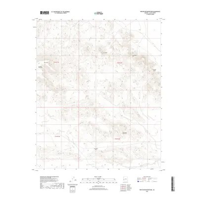
2018 Map of New Water Mountains
USGS Topo · Published 2018About this map
The New Water Mountains dominate this high-desert landscape in La Paz County, presenting a network of ridges and peaks that have long served as landmarks for travelers. Navigating the arid terrain relies on identifying prominent geological features such as Black Mesa and the western edge of the Plomosa Mountains. To the east, distinctive formations like The Eagles Eye and Gunsight Notch provide clear visual reference points for those traversing this portion of the Sonoran Desert.
Find a feature on this map
12 named features on this map. Tap any name to fly to it.
Don’t see what you’re looking for? This feature index may not catch every label — zoom into the map to look around manually.
Map Details
Editions of this 2018 New Water Mountains Map
This is the sole edition of this map. No revisions or reprints were ever made.
Other maps of this area

1942 · Blythe
USGS Topo · 1:250,000

1942 · Vicksburg
USGS Topo · 1:250,000

1954 · Salton Sea
USGS Topo · 1:250,000

1954 · Phoenix
USGS Topo · 1:250,000

1955 · Salton Sea
USGS Topo · 1:250,000

1957 · Phoenix
USGS Topo · 1:250,000

1958 · Phoenix
USGS Topo · 1:250,000

1959 · Salton Sea
USGS Topo · 1:250,000

1960 · Phoenix
USGS Topo · 1:250,000

1962 · Quartzsite
USGS Topo · 1:62,500