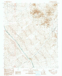
1990 Map of Powerline Well
USGS Topo · Published 1990About this map
The Cactus Plain dominates this landscape, showing a late-twentieth-century transition where traditional desert infrastructure meets modern engineering. The Hayden-Rhodes Aqueduct slices diagonally across the basin, accompanied by a series of access points including a Road On Levee and specific infrastructure like the Gates. This water management system contrasts with older transport and extraction markers, such as the Old Railroad Grade and the Old Lincoln Ranch Road Grade found near Midway.
Find a feature on this map
22 named features on this map. Tap any name to fly to it.
Don’t see what you’re looking for? This feature index may not catch every label — zoom into the map to look around manually.
Map Details
Editions of this 1990 Powerline Well Map
This is the sole edition of this map. No revisions or reprints were ever made.
Other maps of this area

1911 · Parker
USGS Topo · 1:125,000

1923 · Signal
USGS Topo · 1:250,000

1930 · Linskey
USGS Topo · 1:62,500

1942 · Signal
USGS Topo · 1:250,000

1942 · Blythe
USGS Topo · 1:250,000

1942 · Vicksburg
USGS Topo · 1:250,000

1950 · Prescott
USGS Topo · 1:250,000

1954 · Salton Sea
USGS Topo · 1:250,000

1954 · Needles
USGS Topo · 1:250,000

1954 · Prescott
USGS Topo · 1:250,000