Old Maps of Midway, Arizona
Explore 16 old maps of Midway, spanning from 1923 to today. These high-resolution historic maps reveal how streets, neighborhoods, landmarks, and natural features evolved over time — perfect for genealogy, metal detecting, research, and local history exploration.
What you can do with these maps:
- See how Midway changed over time: Compare historical maps to modern-day views to trace roads, homesites, rail lines & more.
- View detailed metadata: Each map includes creators, publishers, year, scale, and archive source.
- Overlay maps with satellite & LiDAR: Visualize the past alongside modern tools to explore terrain & human change.
- Trusted historical sources: Maps sourced from the USGS, Library of Congress, and other archives.
- Access maps your way: View online, download high-res files, or order prints for personal or research use.
Start exploring old maps of Midway to uncover forgotten places, hidden landmarks, and the deep history beneath your feet.
Midway, AZ maps
(16)- 1923 Map of Signal
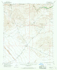
 1923 Signal1923 Print · USGSWestern Arizona in the early twenties was a landscape of isolated mining camps and vital desert springs. Genealogists and historians can trace the footprint of early settlements like Signal and Swansea or locate remote outposts such as Owen and Butler well.
 - 1942 Map of Signal
 1942 Signal1942 Print · USGSNorthwestern Arizona was a rugged network of mining camps and river crossings during the early years of the war. Researchers can trace the isolated roads connecting Signal, the mines at Bagdad, and the remote desert outposts of Swansea and Alamo.
 - 1950 Map of Prescott, 1951 Print
 1950 Prescott1951 Print · USGSArizona's mining and ranching frontiers were in full operation during the early fifties, from the vertical streets of Jerome to the remote western desert. Genealogists and researchers can trace rural life via the Bland School, the United Verde Mine, and stops along the Atchison Topeka and Santa Fe Railway.
 - 1954 Map of Prescott, 1963 Print
 1954 Prescott1963 Print · USGSYavapai County mining and ranching districts are shown in high detail during the mid-twentieth century. Researchers can trace the legacy of remote camps and transport hubs like Swansea, Octave, and the Bagdad Mine along the desert rail lines.4 unique versions available
 - 1958 Map of Prescott
 1958 Prescott1958 Print · USGSCentral Arizona's rugged mining and ranching corridors come alive in the late fifties. Genealogists and historians can trace the remote Trout Creek School, the mining operations at Jerome, and the rail stops at Skull Valley and Kirkland.
 - 1959 Map of Prescott
 1959 Prescott1959 Print · USGSYavapai County and the central Arizona highlands come alive in the late fifties, showcasing a landscape of mountain mining towns and forest outposts. Researchers can trace the industrial footprints of the United Verde Mine, follow the Atchison Topeka and Santa Fe rails, and locate remote settlements like Swansea or Skull Valley.2 unique versions available
 - 1960 Map of Prescott
 1960 Prescott1960 Print · USGSYavapai County and the surrounding high-desert mining districts are captured here during a period of steady industrial and rail activity. Researchers can trace the routes of the Atchison Topeka and Santa Fe Railway and locate historic sites like the United Verde Mine and Bland School.2 unique versions available
 - 1965 Map of Prescott
 1965 Prescott1965 Print · USGSArizona's mining heartland is captured during the mid-sixties, from the copper mines of Jerome to the cattle country of Williamson Valley Wash. Genealogists and historians can trace old mining camps at Octave and Stanton or the historic Whipple Military Reservation.
 - 1966 Map of Swansea, 1967 Print
 1966 Swansea1967 Print · USGSThe Arizona desert of the mid-sixties reveals its mining history here along the Bill Williams River. Genealogists and industrial historians can trace the Old Railroad Grade connecting Swansea and Planet, alongside a Retort Oven and local Cemeteries.2 unique versions available
 - 1979 Map of Alamo Lake, 1997 Print
 1979 Alamo Lake1997 Print · USGSThe Arizona desert at the end of the seventies reveals a landscape of massive water projects and deep-rooted mining history. Genealogists and historians can trace numerous remote claims like the Black Diamond and Nellie-Meda Mine or explore the early footprint of Alamo Lake State Park.2 unique versions available
 - 1990 Map of Powerline Well
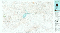
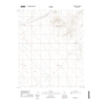
 1990 Powerline Well1990 Print · USGSLa Paz County's high desert is captured here in the 1990s as modern water and power projects began to redefine the traditional landscape. Genealogists and desert historians can trace the Old Railroad Grade and Old Lincoln Ranch Road Grade alongside sites like Midway and Powerline Well.
 - 2011 Map of Powerline Well, 2011 Print
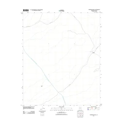 2011 Powerline Well2011 Print · USGSCovers Midway, including Bouse, La Paz County, and other nearby areas
 - 2014 Map of Powerline Well, 2014 Print
 2014 Powerline Well2014 Print · USGSCovers Midway, including Bouse, La Paz County, and other nearby areas
 - 2018 Map of Powerline Well, 2018 Print
 2018 Powerline Well2018 Print · USGSCovers Midway, including Bouse, La Paz County, and other nearby areas
 - 2021 Map of Powerline Well, 2021 Print
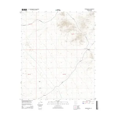
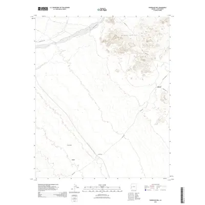
 2021 Powerline Well2021 Print · USGSLa Paz County at the turn of the decade is a study in desert water management and remote settlement. Researchers can trace the massive Central Arizona Project Aqueduct through the Cactus Plain and locate the small outpost of Midway.
 - 2026 Map of Powerline Well, 2026 Print
 2026 Powerline Well2026 Print · USGSCovers Midway, including Bouse, La Paz County, and other nearby areas
End of results
Showing maps 1-16 of 16
Top cities near Midway
Frequently asked questions
- What are the different types of historical maps available for Midway?
- What is the oldest map of Midway?
- Where can I purchase historical maps of Midway for my home or office?
- Where can I download high-res historical maps of Midway?
- Are there historical topographic maps available for Midway?
- Is there historical aerial imagery available for Midway?
- Where are historical maps of Midway sourced from?