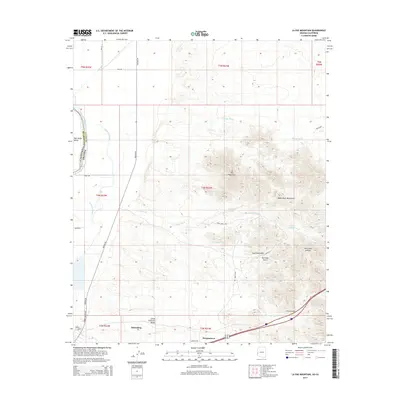
2014 Map of La Paz Mountain
USGS Topo · Published 2014About this map
Ehrenberg and the small settlement of Morgantown anchor this landscape along the border of Arizona and California. The terrain is defined by the stark transition from the fertile Palo Verde Valley and Great Colorado Valley near the Colorado River to the arid elevations of the Dome Rock Mountains. To the west, the Goodman Slough and Besa-Drain illustrate the managed hydrology of the river bottom, while the eastern heights are marked by prominent peaks such as La Paz Mountain.
Find a feature on this map
38 named features on this map. Tap any name to fly to it.
Don’t see what you’re looking for? This feature index may not catch every label — zoom into the map to look around manually.
Map Details
Editions of this 2014 La Paz Mountain Map
This is the sole edition of this map. No revisions or reprints were ever made.
Other maps of this area

1931 · Moon Mtn
USGS Topo · 1:62,500

1932 · Moon Mtn
USGS Topo · 1:62,500

1933 · Cunningham Mtn
USGS Topo · 1:48,000

1940 · Dome Rock Mts
USGS Topo · 1:62,500

1942 · Blythe
USGS Topo · 1:250,000

1942 · MOON MTN
USGS Topo · 1:62,500

1945 · Big Maria Mtns
USGS Topo · 1:62,500

1951 · Big Maria Mts
USGS Topo · 1:62,500

1951 · Blythe
USGS Topo · 1:24,000

1951 · Blythe NE
USGS Topo · 1:24,000