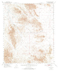
1954 Map of Trigo Peaks
USGS Topo · Published 1976About this map
The Trigo Mountains dominate this arid landscape along the western edge of Yuma Co, characterized by sharp peaks and a complex network of desert washes. Topography by plane-table surveys from the 1930s was updated here in the mid-1950s, revealing a region largely defined by its military use and physical barriers. Large portions of the terrain are designated as a Military Reservation and the Proving Ground Military Reservation, restricting general access across the South Trigo Peaks and into the Chocolate Mts.
Find a feature on this map
29 named features on this map. Tap any name to fly to it.
Don’t see what you’re looking for? This feature index may not catch every label — zoom into the map to look around manually.
Map Details
Editions of this 1954 Trigo Peaks Map
3 editions found

Other maps of this area

1933 · Cunningham Mtn
USGS Topo · 1:48,000

1934 · Trigo Peaks
USGS Topo · 1:48,000

1939 · Red Hill
USGS Topo · 1:62,500

1939 · Trigo Peaks
USGS Topo · 1:62,500

1940 · Dome Rock Mts
USGS Topo · 1:62,500

1942 · Blythe
USGS Topo · 1:250,000

1945 · Cibola
USGS Topo · 1:62,500

1945 · Picacho
USGS Topo · 1:62,500

1951 · Picacho
USGS Topo · 1:62,500

1951 · Blythe
USGS Topo · 1:24,000