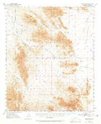
1954 Map of Trigo Peaks
USGS Topo · Published 1965About this map
The Dome Rock Mountains and the North Trigo Peaks dominate this mid-century survey of the arid borderlands of Yuma and La Paz counties. This is a landscape defined by seasonal water and difficult passage, where survival for early travelers depended on landmarks like the White Tanks and Mohave Tanks. A sparse network of early transportation routes, including the Gould Trail and several unnamed Jeep Trails, connect the basin floors to high mountain gaps such as Weaver Pass and Felipe Pass.
Find a feature on this map
33 named features on this map. Tap any name to fly to it.
Don’t see what you’re looking for? This feature index may not catch every label — zoom into the map to look around manually.
Map Details
Editions of this 1954 Trigo Peaks Map
3 editions found

Other maps of this area

1933 · Cunningham Mtn
USGS Topo · 1:48,000

1934 · Trigo Peaks
USGS Topo · 1:48,000

1939 · Red Hill
USGS Topo · 1:62,500

1939 · Trigo Peaks
USGS Topo · 1:62,500

1940 · Dome Rock Mts
USGS Topo · 1:62,500

1942 · Blythe
USGS Topo · 1:250,000

1945 · Cibola
USGS Topo · 1:62,500

1945 · Picacho
USGS Topo · 1:62,500

1951 · Picacho
USGS Topo · 1:62,500

1951 · Blythe
USGS Topo · 1:24,000