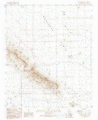
1990 Map of New Water Well
USGS Topo · Published 1990About this map
The New Water Mountains dominate the southwestern portion of this Arizona landscape, casting a sharp shadow across the Ranegras Plain. This 1990 survey captures a remote desert environment where water management is the primary evidence of human modification. Infrastructural markers such as Check Dams, Crowder Tank, and the eponymous New Water Well indicate the critical importance of moisture in this arid corridor. To the south, the boundary of the Kofa National Wildlife Refuge marks a transition into protected lands, where the solitary Kofa Cabin sits near the drainage of Alamo Wash. The presence of a Landing Strip in the northeast and crossing Pipeline and Trans Line corridors underscores how this space serves as a functional thoroughfare for energy and transport between distant desert hubs.
Find a feature on this map
13 named features on this map. Tap any name to fly to it.
Don’t see what you’re looking for? This feature index may not catch every label — zoom into the map to look around manually.
Map Details
Editions of this 1990 New Water Well Map
This is the sole edition of this map. No revisions or reprints were ever made.
Other maps of this area

1942 · Vicksburg
USGS Topo · 1:250,000

1954 · Phoenix
USGS Topo · 1:250,000

1957 · Phoenix
USGS Topo · 1:250,000

1958 · Phoenix
USGS Topo · 1:250,000

1960 · Phoenix
USGS Topo · 1:250,000

1961 · Hope
USGS Topo · 1:62,500

1962 · Little Horn Mts
USGS Topo · 1:62,500

1962 · Kofa Butte
USGS Topo · 1:62,500

1962 · Vicksburg
USGS Topo · 1:62,500

1969 · Phoenix
USGS Topo · 1:250,000