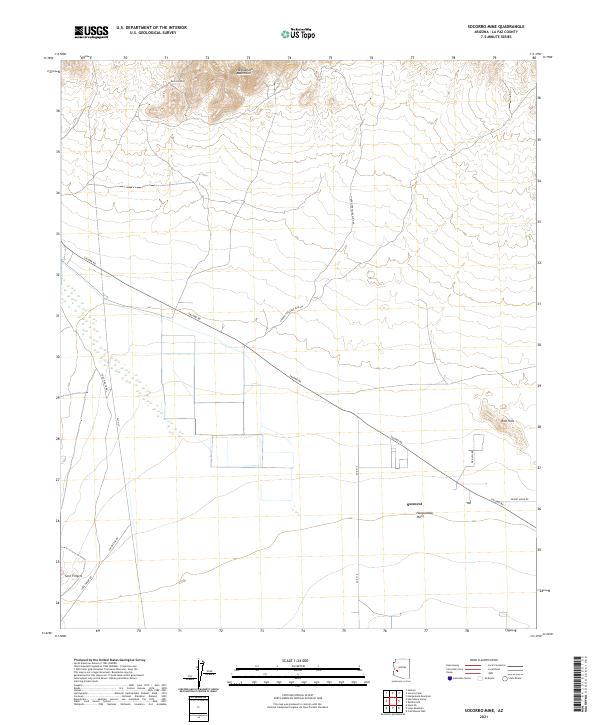
2021 Map of Socorro Mine
USGS Topo · Published 2021About this map
Socorro Mine sits at the northern edge of this La Paz County map, tucked into the rugged slopes of the Harquahala Mountains. This area illustrates the transition from high desert peaks to the broad, flat expanse of the Harquahala Plain to the south. The small settlement at Sunwest serves as a localized point of interest within this arid landscape, which is navigated by a network of desert roads including Salome Rd and the evocatively named Hidden Treasure Mine Rd. To the west and south, the terrain is marked by distinctive formations such as the Red Hills and the craggy outcrops of Sore Fingers, highlighting a geography defined by historical mining activity and sparse desert habitation.
Find a feature on this map
20 named features on this map. Tap any name to fly to it.
Don’t see what you’re looking for? This feature index may not catch every label — zoom into the map to look around manually.
Map Details
Editions of this 2021 Socorro Mine Map
This is the sole edition of this map. No revisions or reprints were ever made.
Other maps of this area

1942 · Vicksburg
USGS Topo · 1:250,000

1954 · Phoenix
USGS Topo · 1:250,000

1957 · Phoenix
USGS Topo · 1:250,000

1958 · Phoenix
USGS Topo · 1:250,000

1960 · Phoenix
USGS Topo · 1:250,000

1961 · Salome
USGS Topo · 1:62,500

1961 · Hope
USGS Topo · 1:62,500

1961 · Lone Mountain
USGS Topo · 1:62,500

1961 · Gladden
USGS Topo · 1:62,500

1969 · Phoenix
USGS Topo · 1:250,000