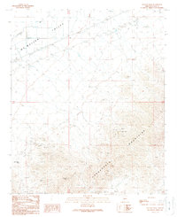
1989 Map of Socorro Peak
USGS Topo · Published 1990About this map
Harquahala Mountains dominate the southern half of this landscape, rising sharply from the Mc Mullen Valley floor. The terrain reveals a significant history of resource extraction, particularly concentrated around the San Marcos Mine and the White Marble Mine. Numerous prospects, adits, and mine shafts are scattered across the slopes, indicating a landscape heavily shaped by mineral exploration. In the lower elevations, the influence of water management is visible through an extensive network of levees designed to control the flow of Centennial Wash as it moves toward the valley basin. Transportation and travelers are served by a roadside park and a trailer park along the highway corridor, while Tenahatchipi Pass provides a natural transit point through the high ground. The presence of the Usmm 2408 mineral monument further underscores the importance of mining claims in this corner of La Paz County.
Find a feature on this map
21 named features on this map. Tap any name to fly to it.
Don’t see what you’re looking for? This feature index may not catch every label — zoom into the map to look around manually.
Map Details
Editions of this 1989 Socorro Peak Map
This is the sole edition of this map. No revisions or reprints were ever made.
Other maps of this area

1942 · Vicksburg
USGS Topo · 1:250,000

1954 · Phoenix
USGS Topo · 1:250,000

1957 · Phoenix
USGS Topo · 1:250,000

1958 · Phoenix
USGS Topo · 1:250,000

1960 · Phoenix
USGS Topo · 1:250,000

1961 · Salome
USGS Topo · 1:62,500

1961 · Hope
USGS Topo · 1:62,500

1961 · Lone Mountain
USGS Topo · 1:62,500

1961 · Gladden
USGS Topo · 1:62,500

1969 · Phoenix
USGS Topo · 1:250,000