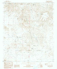
1990 Map of Crystal Hill
USGS Topo · Published 1990About this map
Kofa National Wildlife Refuge dominates the southern landscape of this Arizona quadrangle, where the arid desert floor meets the rising peaks of the Plomosa Mountains and the Livingston Hills. The area is defined by its mining heritage, evidenced by a dense concentration of historical claims and shafts. Operations like the Apache Chief Mine and the Poorman Mine are recorded alongside various unnamed prospects and adits that follow the mountain ridges. Resource extraction was supported by critical water sources such as Livingstons Well, Twelvemile Well, and the Dripping Spring. The map captures a rugged terrain carved by intermittent washes, including Plomosita Wash and Italian Wash, illustrating the sparse but vital infrastructure of pipelines and four-wheel-drive trails required to navigate and work the mineral-rich land.
Find a feature on this map
37 named features on this map. Tap any name to fly to it.
Don’t see what you’re looking for? This feature index may not catch every label — zoom into the map to look around manually.
Map Details
Editions of this 1990 Crystal Hill Map
This is the sole edition of this map. No revisions or reprints were ever made.
Other maps of this area

1942 · Blythe
USGS Topo · 1:250,000

1942 · Vicksburg
USGS Topo · 1:250,000

1954 · Salton Sea
USGS Topo · 1:250,000

1954 · Phoenix
USGS Topo · 1:250,000

1955 · Salton Sea
USGS Topo · 1:250,000

1957 · Phoenix
USGS Topo · 1:250,000

1958 · Phoenix
USGS Topo · 1:250,000

1959 · Salton Sea
USGS Topo · 1:250,000

1960 · Phoenix
USGS Topo · 1:250,000

1962 · Quartzsite
USGS Topo · 1:62,500