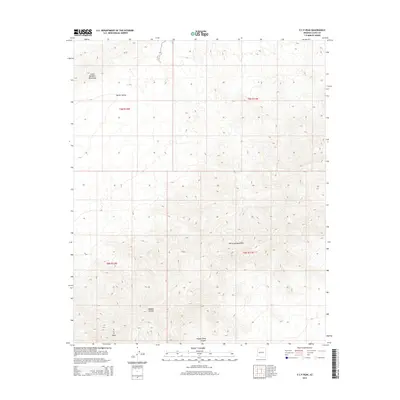
2014 Map of E C P Peak
USGS Topo · Published 2014About this map
E C P Peak stands as a prominent high point in this desert landscape, part of a rugged chain where the Little Buckskin Mountains meet the northern edge of Butler Valley. The terrain is defined by deep drainage systems and sharp elevation changes, notably through the corridors of Webber Canyon and Happy Camp Canyon. This 2014 survey captures the vast, undeveloped character of northwestern Arizona, showing the reach of the Harcuvar Mountains across the eastern portion of the quadrangle. The lack of established settlements or man-made infrastructure on this sheet emphasizes the isolation of these mountain ranges, providing a clear topographic record of the untouched public lands in La Paz County.
Find a feature on this map
10 named features on this map. Tap any name to fly to it.
Don’t see what you’re looking for? This feature index may not catch every label — zoom into the map to look around manually.
Map Details
Editions of this 2014 E C P Peak Map
This is the sole edition of this map. No revisions or reprints were ever made.
Other maps of this area
1923 · Signal
USGS Topo · 1:250,000
1942 · Signal
USGS Topo · 1:250,000
1942 · Vicksburg
USGS Topo · 1:250,000
1950 · Prescott
USGS Topo · 1:250,000
1954 · Prescott
USGS Topo · 1:250,000
1954 · Phoenix
USGS Topo · 1:250,000
1957 · Phoenix
USGS Topo · 1:250,000
1958 · Prescott
USGS Topo · 1:250,000
1958 · Phoenix
USGS Topo · 1:250,000
1959 · Prescott
USGS Topo · 1:250,000