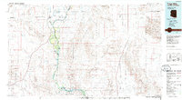
1986 Map of Trigo Mts
USGS Topo · Published 1986About this map
The Colorado River carves a green path through the arid borderlands of Arizona and California, anchoring a landscape defined by military ranges and massive wildlife sanctuaries in the mid-1980s. Agricultural activity in the Palo Verde Valley near Palo Verde contrasts with the surrounding desert, where the Yuma Proving Ground and the Chocolate Mountain Aerial Gunnery Range dominate the terrain. Along the river's meandering course, specialized riverside sites like Paymaster Landing and Walters Camp provided access points for river travelers and local commerce.
Find a feature on this map
63 named features on this map. Tap any name to fly to it.
Don’t see what you’re looking for? This feature index may not catch every label — zoom into the map to look around manually.
Map Details
Editions of this 1986 Trigo Mts Map
2 editions found
Other maps of this area

1903 · Yuma
USGS Topo · 1:125,000

1905 · Yuma
USGS Topo · 1:125,000

1907 · Holtville
USGS Topo · 1:125,000

1928 · Norton
USGS Topo · 1:62,500

1929 · Laguna
USGS Topo · 1:62,500

1929 · Norton
USGS Topo · 1:62,500

1933 · Cunningham Mtn
USGS Topo · 1:48,000

1934 · Trigo Peaks
USGS Topo · 1:48,000

1939 · Red Hill
USGS Topo · 1:62,500

1939 · Trigo Peaks
USGS Topo · 1:62,500