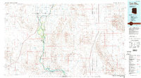
1986 Map of Trigo Mts
USGS Topo · Published 1986About this map
The Colorado River serves as the central artery for this arid borderland, defining the boundary between Arizona and California. Along its lush banks, the Cibola National Wildlife Refuge and Imperial National Wildlife Refuge protect a network of riparian habitats, including Adobe Lake, Taylor Lake, and Three Finger Lake. This corridor contrasts sharply with the surrounding desert, where settlements like Palo Verde and Picacho are established near the water's edge.
Find a feature on this map
75 named features on this map. Tap any name to fly to it.
Don’t see what you’re looking for? This feature index may not catch every label — zoom into the map to look around manually.
Map Details
Editions of this 1986 Trigo Mts Map
2 editions found
Other maps of this area

1903 · Yuma
USGS Topo · 1:125,000

1905 · Yuma
USGS Topo · 1:125,000

1907 · Holtville
USGS Topo · 1:125,000

1928 · Norton
USGS Topo · 1:62,500

1929 · Laguna
USGS Topo · 1:62,500

1929 · Norton
USGS Topo · 1:62,500

1933 · Cunningham Mtn
USGS Topo · 1:48,000

1934 · Trigo Peaks
USGS Topo · 1:48,000

1939 · Red Hill
USGS Topo · 1:62,500

1939 · Trigo Peaks
USGS Topo · 1:62,500