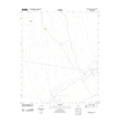
2011 Map of Webber Canyon
USGS Topo · Published 2011About this map
The Harcuvar Mountains dominate the northwestern portion of this 2011 topographic study in La Paz County, Arizona. This desert landscape is defined by its drainage patterns, with Webber Canyon cutting through the arid terrain as a primary natural feature. In the southeast, the Miller Reservoir provides a concentrated point of water management, accompanied by a network of local roads that serve this corner of the Sonoran Desert. The sparse settlement pattern is emphasized by the presence of Urea Ranch Rd, which connects the basin floor to more developed routes outside the quadrangle. The map captures the region's topography before significant modern expansion, focusing on the essential relationship between the seasonal watercourses of the canyon and the harsh mountain slopes.
Find a feature on this map
4 named features on this map. Tap any name to fly to it.
Don’t see what you’re looking for? This feature index may not catch every label — zoom into the map to look around manually.
Map Details
Editions of this 2011 Webber Canyon Map
This is the sole edition of this map. No revisions or reprints were ever made.
Other maps of this area

1923 · Signal
USGS Topo · 1:250,000

1942 · Signal
USGS Topo · 1:250,000

1942 · Vicksburg
USGS Topo · 1:250,000

1950 · Prescott
USGS Topo · 1:250,000

1954 · Prescott
USGS Topo · 1:250,000

1954 · Phoenix
USGS Topo · 1:250,000

1957 · Phoenix
USGS Topo · 1:250,000

1958 · Prescott
USGS Topo · 1:250,000

1958 · Phoenix
USGS Topo · 1:250,000

1959 · Prescott
USGS Topo · 1:250,000