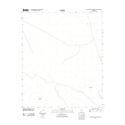
2011 Map of Little Horn Mountains NE
USGS Topo · Published 2011About this map
Little Horn Mountains dominate the southern portion of this desert quadrangle, where the arid landscape is defined by drainage patterns and isolation. Deadman Mountain rises as a prominent landmark in the southeast, situated near the headwaters of Deadman Wash. This 2011 survey documents a sparsely developed region of La Paz County, where human presence is largely restricted to infrastructure like the Palomas Harquahala Rd cutting through the eastern corridor. The map illustrates a high-desert environment where water management is critical, evidenced by the presence of Talon Tank in the north. The lack of settlements or varied industrial markings highlights the preservation of this open desert space in the early 21st century.
Find a feature on this map
5 named features on this map. Tap any name to fly to it.
Don’t see what you’re looking for? This feature index may not catch every label — zoom into the map to look around manually.
Map Details
Editions of this 2011 Little Horn Mountains NE Map
This is the sole edition of this map. No revisions or reprints were ever made.
Other maps of this area

1942 · Vicksburg
USGS Topo · 1:250,000

1954 · Phoenix
USGS Topo · 1:250,000

1957 · Phoenix
USGS Topo · 1:250,000

1958 · Phoenix
USGS Topo · 1:250,000

1960 · Phoenix
USGS Topo · 1:250,000

1961 · Hope
USGS Topo · 1:62,500

1961 · Lone Mountain
USGS Topo · 1:62,500

1962 · Little Horn Mts
USGS Topo · 1:62,500

1962 · Eagletail Mts
USGS Topo · 1:62,500

1969 · Phoenix
USGS Topo · 1:250,000