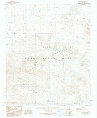
1990 Map of Owl Head
USGS Topo · Published 1990About this map
Kofa National Wildlife Refuge encompasses the majority of this arid landscape in the Kofa Mountains, where human presence is defined primarily by small-scale resource extraction and water management. Numerous mining operations dot the terrain, ranging from the Midas Mine and the Ocotillo Group Mine to various unnamed Mine Shafts, Adits, and Open Pit Mines. These workings reflect a history of prospecting along the base of the peaks and deep into the desert washes.
Find a feature on this map
32 named features on this map. Tap any name to fly to it.
Don’t see what you’re looking for? This feature index may not catch every label — zoom into the map to look around manually.
Map Details
Editions of this 1990 Owl Head Map
This is the sole edition of this map. No revisions or reprints were ever made.
Other maps of this area

1942 · Blythe
USGS Topo · 1:250,000

1942 · Vicksburg
USGS Topo · 1:250,000

1954 · Salton Sea
USGS Topo · 1:250,000

1954 · Phoenix
USGS Topo · 1:250,000

1955 · Salton Sea
USGS Topo · 1:250,000

1957 · Phoenix
USGS Topo · 1:250,000

1958 · Phoenix
USGS Topo · 1:250,000

1959 · Salton Sea
USGS Topo · 1:250,000

1960 · Phoenix
USGS Topo · 1:250,000

1962 · Quartzsite
USGS Topo · 1:62,500