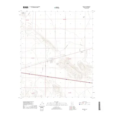
2018 Map of Bear Hills
USGS Topo · Published 2018About this map
The Plomosa Mountains and the elevated desert terrain of the Bear Hills dominate this section of La Paz County. The small community of Brenda sits at a critical junction of transportation routes, where modern interstate travel meets older local thoroughfares. To the northeast, the terrain levels out into the Ranegras Plain, illustrating the transition from rocky outcrops to open desert basins. The local road network reveals layers of history, including the northern Stage Coach Rd and the centrally located Pioneer settlement. Resource extraction and transit are central themes of the landscape, evidenced by Ramsey Mine Rd and Black Rock Tank Rd, which connect the scattered homesteads and industrial interests to the primary corridors through the desert.
Find a feature on this map
20 named features on this map. Tap any name to fly to it.
Don’t see what you’re looking for? This feature index may not catch every label — zoom into the map to look around manually.
Map Details
Editions of this 2018 Bear Hills Map
This is the sole edition of this map. No revisions or reprints were ever made.
Other maps of this area

1930 · Linskey
USGS Topo · 1:62,500

1942 · Blythe
USGS Topo · 1:250,000

1942 · Vicksburg
USGS Topo · 1:250,000

1954 · Salton Sea
USGS Topo · 1:250,000

1954 · Phoenix
USGS Topo · 1:250,000

1955 · Salton Sea
USGS Topo · 1:250,000

1957 · Phoenix
USGS Topo · 1:250,000

1958 · Phoenix
USGS Topo · 1:250,000

1959 · Salton Sea
USGS Topo · 1:250,000

1960 · Phoenix
USGS Topo · 1:250,000