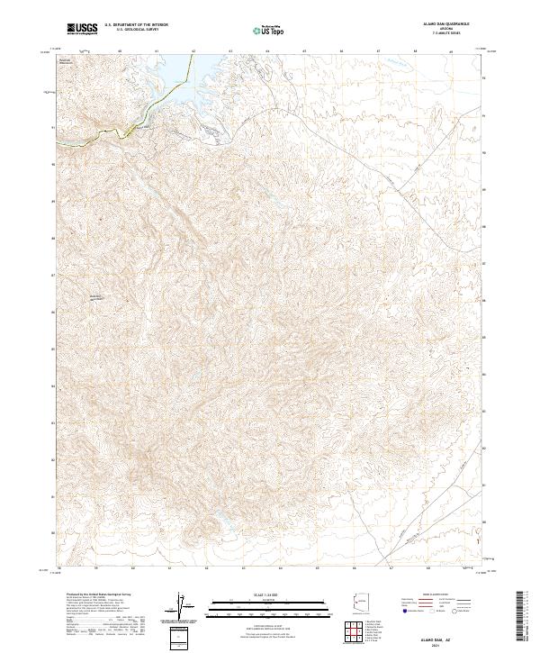
2021 Map of Alamo Dam
USGS Topo · Published 2021About this map
Alamo Dam serves as the focal point of this arid desert landscape at the meeting of the Mohave and La Paz county line. The map illustrates the convergence of several major drainage systems into Alamo Lake, including the Bill Williams River, Bullard Wash, and Ives Wash. This hydrological infrastructure is framed by the steep rising elevations of the Buckskin Mountains to the south and the Rawhide Mountains to the northwest.
Find a feature on this map
22 named features on this map. Tap any name to fly to it.
Don’t see what you’re looking for? This feature index may not catch every label — zoom into the map to look around manually.
Map Details
Editions of this 2021 Alamo Dam Map
This is the sole edition of this map. No revisions or reprints were ever made.
Other maps of this area

1923 · Signal
USGS Topo · 1:250,000

1942 · Signal
USGS Topo · 1:250,000

1950 · Prescott
USGS Topo · 1:250,000

1954 · Prescott
USGS Topo · 1:250,000

1958 · Prescott
USGS Topo · 1:250,000

1959 · Prescott
USGS Topo · 1:250,000

1960 · Prescott
USGS Topo · 1:250,000

1965 · Prescott
USGS Topo · 1:250,000

1966 · Ives Peak
USGS Topo · 1:62,500

1966 · Artillery Peak
USGS Topo · 1:62,500