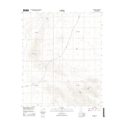
2014 Map of Ibex Peak
USGS Topo · Published 2014About this map
Bouse sits on the eastern edge of a dramatic desert landscape dominated by the Plomosa Mountains. The terrain transitions from the low-lying flats near Plomosa Dr to the sharp rises of prominent landforms like Ibex Peak and Haystack Peak in the southeast. This 2014 survey captures the layout of the region's transport network, centered on the junction of Plomosa Rd as it cuts through the arid basins. To the north, the elevation climbs toward Four Peaks, illustrating the rugged topography that defines this corner of La Paz County. The map provides a clear look at the township and range boundaries, including t6n r17w and t5n r18w, which organize the vast, open tracts of land surrounding the small settlement.
Find a feature on this map
11 named features on this map. Tap any name to fly to it.
Don’t see what you’re looking for? This feature index may not catch every label — zoom into the map to look around manually.
Map Details
Editions of this 2014 Ibex Peak Map
This is the sole edition of this map. No revisions or reprints were ever made.
Other maps of this area

1930 · Linskey
USGS Topo · 1:62,500

1942 · Blythe
USGS Topo · 1:250,000

1942 · Vicksburg
USGS Topo · 1:250,000

1954 · Salton Sea
USGS Topo · 1:250,000

1954 · Phoenix
USGS Topo · 1:250,000

1955 · Salton Sea
USGS Topo · 1:250,000

1957 · Phoenix
USGS Topo · 1:250,000

1958 · Phoenix
USGS Topo · 1:250,000

1959 · Salton Sea
USGS Topo · 1:250,000

1960 · Phoenix
USGS Topo · 1:250,000