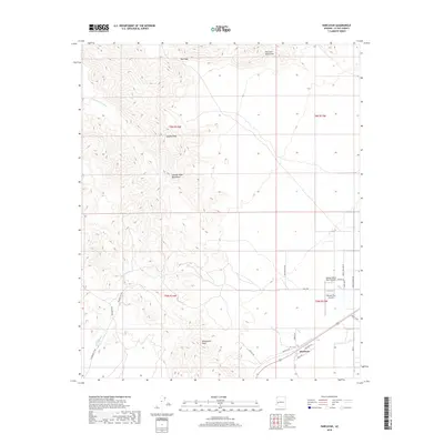
2018 Map of Harcuvar
USGS Topo · Published 2018About this map
The rugged topography of the Harcuvar Mountains and Granite Wash Mountains dominates this portion of La Paz County. High points such as Salome Peak and Winchester Peak define the skyline, while drainage follows the courses of Big Granite Wash, Calcite Wash, and Salome Wash. These arid corridors have historically shaped movement through the desert, most notably at Tank Pass.
Find a feature on this map
28 named features on this map. Tap any name to fly to it.
Don’t see what you’re looking for? This feature index may not catch every label — zoom into the map to look around manually.
Map Details
Editions of this 2018 Harcuvar Map
This is the sole edition of this map. No revisions or reprints were ever made.
Other maps of this area

1942 · Vicksburg
USGS Topo · 1:250,000

1954 · Phoenix
USGS Topo · 1:250,000

1957 · Phoenix
USGS Topo · 1:250,000

1958 · Phoenix
USGS Topo · 1:250,000

1960 · Phoenix
USGS Topo · 1:250,000

1961 · Salome
USGS Topo · 1:62,500

1961 · Hope
USGS Topo · 1:62,500
1962 · Utting
USGS Topo · 1:62,500

1962 · Vicksburg
USGS Topo · 1:62,500

1969 · Phoenix
USGS Topo · 1:250,000