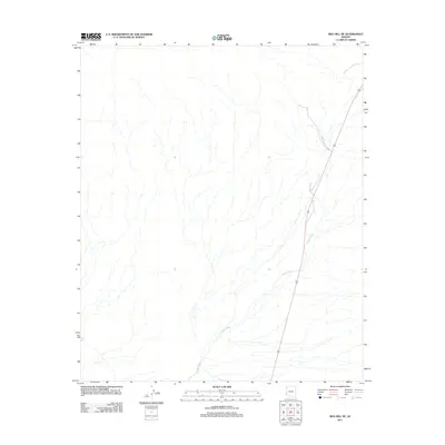
2011 Map of Red Hill NE
USGS Topo · Published 2011About this map
Yuma Proving Ground defines the eastern boundary of this desert landscape in La Paz County, where the military installation overlaps with the natural drainage of the region. The map is centered on the extensive network of Indian Wash, which meanders across the arid terrain from the southwest toward the military zone. A single primary transportation corridor, US Route 95, bisects the eastern portion of the quadrangle, serving as the main artery through this sparsely developed area. The convergence of these few features—a major wash, a strategic military reservation, and a lone highway—illustrates the characteristic land use and isolation of the Arizona desert during this era.
Find a feature on this map
3 named features on this map. Tap any name to fly to it.
Don’t see what you’re looking for? This feature index may not catch every label — zoom into the map to look around manually.
Map Details
Editions of this 2011 Red Hill NE Map
This is the sole edition of this map. No revisions or reprints were ever made.
Other maps of this area

1934 · Trigo Peaks
USGS Topo · 1:48,000

1939 · Red Hill
USGS Topo · 1:62,500

1939 · Trigo Peaks
USGS Topo · 1:62,500

1942 · Blythe
USGS Topo · 1:250,000

1954 · Salton Sea
USGS Topo · 1:250,000

1954 · Red Hill
USGS Topo · 1:62,500

1954 · Trigo Peaks
USGS Topo · 1:62,500

1955 · Salton Sea
USGS Topo · 1:250,000

1959 · Salton Sea
USGS Topo · 1:250,000
1962 · Livingston Hills
USGS Topo · 1:62,500