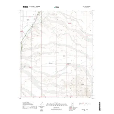
2018 Map of Mule Wash
USGS Topo · Published 2018About this map
The Colorado River forms a sharp geographical and political divide on this 2018 survey, separating Riverside and La Paz counties as well as California and Arizona. To the west, the Palo Verde Valley shows a managed landscape defined by water engineering, including the D-23-1 Canal, D 23 Spill, and Borrow Pit Drain. This fertile valley floor contrasts sharply with the arid eastern bank, where the Great Colorado Valley meets the rising elevations of the Trigo Mountains. The desert terrain is dissected by numerous drainage systems, most notably the namesake Mule Wash, along with Mohave Wash and the distinctively named Crazy Woman Wash. These ephemeral watercourses illustrate the natural drainage patterns of the desert floor before they reach the main river channel. Primitive desert routes like Ehrenberg-Cibola Rd provide the primary access through this remote borderland.
Find a feature on this map
26 named features on this map. Tap any name to fly to it.
Don’t see what you’re looking for? This feature index may not catch every label — zoom into the map to look around manually.
Map Details
Editions of this 2018 Mule Wash Map
This is the sole edition of this map. No revisions or reprints were ever made.
Other maps of this area

1933 · Cunningham Mtn
USGS Topo · 1:48,000

1934 · Trigo Peaks
USGS Topo · 1:48,000

1939 · Trigo Peaks
USGS Topo · 1:62,500

1940 · Dome Rock Mts
USGS Topo · 1:62,500

1942 · Blythe
USGS Topo · 1:250,000

1945 · Cibola
USGS Topo · 1:62,500

1951 · Blythe
USGS Topo · 1:24,000

1951 · Cibola
USGS Topo · 1:62,500

1952 · Mule Wash
USGS Topo · 1:24,000

1952 · Palo Verde
USGS Topo · 1:24,000