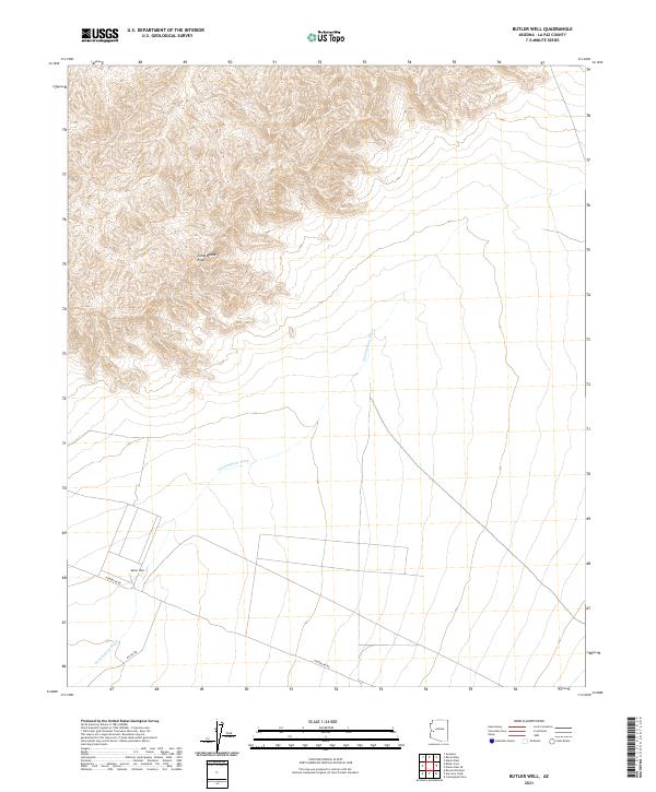
2021 Map of Butler Well
USGS Topo · Published 2021About this map
Butler Well serves as a central landmark in this arid portion of La Paz County, situated near the intersection of Powerline Rd and Mc Vay Rd. The landscape is defined by the drainage of Cunningham Wash, which meanders across the lower terrain, contrasting with the steep contour lines of the northern highlands. The mapping reflects the Bureau of Land Management's township and range system, specifically within t9n r14w, t9n r13w, t8n r14w, and t8n r13w. These boundaries highlight the remote nature of the region, where infrastructure like power lines and graded roads are the primary human markers against the natural washes and rugged topography of the Arizona desert.
Find a feature on this map
8 named features on this map. Tap any name to fly to it.
Don’t see what you’re looking for? This feature index may not catch every label — zoom into the map to look around manually.
Map Details
Editions of this 2021 Butler Well Map
This is the sole edition of this map. No revisions or reprints were ever made.
Other maps of this area

1923 · Signal
USGS Topo · 1:250,000

1942 · Signal
USGS Topo · 1:250,000

1942 · Vicksburg
USGS Topo · 1:250,000

1950 · Prescott
USGS Topo · 1:250,000

1954 · Prescott
USGS Topo · 1:250,000

1954 · Phoenix
USGS Topo · 1:250,000

1957 · Phoenix
USGS Topo · 1:250,000

1958 · Prescott
USGS Topo · 1:250,000

1958 · Phoenix
USGS Topo · 1:250,000

1959 · Prescott
USGS Topo · 1:250,000