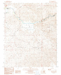
1990 Map of Reid Valley
USGS Topo · Published 1990About this map
Rawhide Mountains and the Buckskin Mountains frame a landscape defined by the winding course of the Bill Williams River. This remote desert corridor in La Paz and Mohave County is marked by a deep history of mineral exploration, evidenced by numerous prospects and adits flanking the river valley. The map documents industrial footprints such as the Arizona-Montana Mine and Bluebell Mine, while lower-lying areas show the attempts to manage water and livestock at Lincoln Ranch and Rankin Ranch. Small-scale infrastructure like the Levee, Corral, and several Check Dams illustrate the challenges of maintaining a foothold in Reid Valley, where seasonal drainage like Mississippi Wash cuts through the arid terrain.
Find a feature on this map
29 named features on this map. Tap any name to fly to it.
Don’t see what you’re looking for? This feature index may not catch every label — zoom into the map to look around manually.
Map Details
Editions of this 1990 Reid Valley Map
This is the sole edition of this map. No revisions or reprints were ever made.
Other maps of this area

1923 · Signal
USGS Topo · 1:250,000

1942 · Signal
USGS Topo · 1:250,000

1950 · Prescott
USGS Topo · 1:250,000

1954 · Prescott
USGS Topo · 1:250,000

1958 · Prescott
USGS Topo · 1:250,000

1959 · Prescott
USGS Topo · 1:250,000

1960 · Prescott
USGS Topo · 1:250,000

1965 · Prescott
USGS Topo · 1:250,000
1966 · Swansea
USGS Topo · 1:62,500

1966 · Ives Peak
USGS Topo · 1:62,500