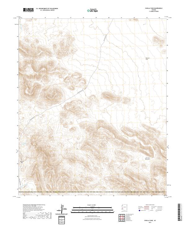
2021 Map of Cholla Tank
USGS Topo · Published 2021About this map
The Little Horn Mountains define the high ground of this Arizona landscape, where elevation shifts dramatically toward the Ranegras Plain to the northeast. This 2021 survey documents a remote corridor on the border of La Paz and Yuma counties, centered on the passage between peaks at Red Rock Pass. Human infrastructure is sparse, characterized primarily by the Kofa Manganese Rd, which winds through the mountain terrain to connect isolated points in the desert.
Find a feature on this map
14 named features on this map. Tap any name to fly to it.
Don’t see what you’re looking for? This feature index may not catch every label — zoom into the map to look around manually.
Map Details
Editions of this 2021 Cholla Tank Map
This is the sole edition of this map. No revisions or reprints were ever made.
Other maps of this area

1942 · Vicksburg
USGS Topo · 1:250,000

1954 · Phoenix
USGS Topo · 1:250,000

1957 · Phoenix
USGS Topo · 1:250,000

1958 · Phoenix
USGS Topo · 1:250,000

1960 · Phoenix
USGS Topo · 1:250,000

1961 · Hope
USGS Topo · 1:62,500

1962 · Little Horn Mts
USGS Topo · 1:62,500

1962 · Kofa Butte
USGS Topo · 1:62,500

1962 · Vicksburg
USGS Topo · 1:62,500

1969 · Phoenix
USGS Topo · 1:250,000