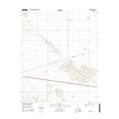
2014 Map of Bear Hills
USGS Topo · Published 2014About this map
Brenda serves as a central hub in this arid landscape where the Ranegras Plain meets the rugged slopes of the Bear Hills. This region of La Paz County is defined by a sparse network of roads like Ramsey Mine Rd and Twin Buttes, which hint at the area's prospecting history and connectivity across the desert floor. The settlement of Vicksburg and the location of Pioneer anchor the northeastern portion of the map, situated along the primary transportation corridor of Us-60. In the northwest, the Plomosa Mountains rise abruptly, creating a stark visual contrast with the surrounding flats. The map illustrates a typical Southwestern pattern of development, where modern highways follow the natural grades used by earlier desert travelers and miners.
Find a feature on this map
24 named features on this map. Tap any name to fly to it.
Don’t see what you’re looking for? This feature index may not catch every label — zoom into the map to look around manually.
Map Details
Editions of this 2014 Bear Hills Map
This is the sole edition of this map. No revisions or reprints were ever made.
Other maps of this area

1930 · Linskey
USGS Topo · 1:62,500

1942 · Blythe
USGS Topo · 1:250,000

1942 · Vicksburg
USGS Topo · 1:250,000

1954 · Salton Sea
USGS Topo · 1:250,000

1954 · Phoenix
USGS Topo · 1:250,000

1955 · Salton Sea
USGS Topo · 1:250,000

1957 · Phoenix
USGS Topo · 1:250,000

1958 · Phoenix
USGS Topo · 1:250,000

1959 · Salton Sea
USGS Topo · 1:250,000

1960 · Phoenix
USGS Topo · 1:250,000