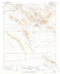
1961 Map of Hope
USGS Topo · Published 1967About this map
Golden Eagle Mine and the Harquahala Mine anchor the rugged high ground of the Little Harquahala Mountains in this early 1960s study of the Arizona desert. The map captures a transition from the industrial activity of these high-altitude mines to the vast, arid reaches of the Harquahala Plain and the Ranegras Plain. Along the northern edge, the Atchison Topeka and Santa Fe railroad corridor serves the small settlements of Hope and Harrisburg, following the natural passage through Granite Wash Pass.
Find a feature on this map
32 named features on this map. Tap any name to fly to it.
Don’t see what you’re looking for? This feature index may not catch every label — zoom into the map to look around manually.
Map Details
Editions of this 1961 Hope Map
2 editions found
Other maps of this area

1942 · Vicksburg
USGS Topo · 1:250,000

1954 · Phoenix
USGS Topo · 1:250,000

1957 · Phoenix
USGS Topo · 1:250,000

1958 · Phoenix
USGS Topo · 1:250,000

1960 · Phoenix
USGS Topo · 1:250,000

1961 · Salome
USGS Topo · 1:62,500

1961 · Hope
USGS Topo · 1:62,500

1961 · Lone Mountain
USGS Topo · 1:62,500

1961 · Gladden
USGS Topo · 1:62,500

1962 · Little Horn Mts
USGS Topo · 1:62,500