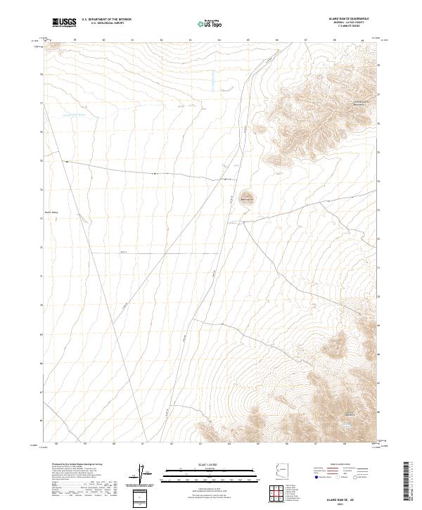
2021 Map of Alamo Dam SE
USGS Topo · Published 2021About this map
Butler Valley forms a broad desert floor in this western Arizona landscape, positioned between the striking heights of the Little Buckskin Mountains to the northeast and the Harcuvar Mountains to the southeast. The terrain is defined by its drainage patterns, most notably the seasonal course of Cunningham Wash which winds through the western half of the territory. Isolated geological features like Black Butte rise abruptly from the basin floor, serving as distinct navigational landmarks. Human movement through this arid environment is channeled primarily along Alamo Rd, which provides access to the interior. While the landscape is largely open, the presence of Dripping Spring in the Harcuvar range indicates a vital water source that has historically anchored activity in an otherwise dry and formidable desert expanse.
Find a feature on this map
12 named features on this map. Tap any name to fly to it.
Don’t see what you’re looking for? This feature index may not catch every label — zoom into the map to look around manually.
Map Details
Editions of this 2021 Alamo Dam SE Map
This is the sole edition of this map. No revisions or reprints were ever made.
Other maps of this area

1923 · Signal
USGS Topo · 1:250,000

1942 · Signal
USGS Topo · 1:250,000

1942 · Vicksburg
USGS Topo · 1:250,000

1950 · Prescott
USGS Topo · 1:250,000

1954 · Prescott
USGS Topo · 1:250,000

1954 · Phoenix
USGS Topo · 1:250,000

1957 · Phoenix
USGS Topo · 1:250,000

1958 · Prescott
USGS Topo · 1:250,000

1958 · Phoenix
USGS Topo · 1:250,000

1959 · Prescott
USGS Topo · 1:250,000