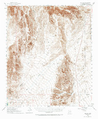
1954 Map of Red Hill
USGS Topo · Published 1973About this map
Trigo Mountains and the Middle Mountains dominate this arid landscape, which in the mid-1950s served as a critical intersection of federal land management and military activity. The expansive Yuma Test Station occupies the central basin, bordered by a Military Reservation that transitions into the rugged Castle Dome Plain. The southwestern corner is marked by the Imperial National Wildlife Refuge along the Colorado River corridor. Economic and cultural history is evidenced by resource extraction and early transit, including the Castle Dome Mine, the Annie Mine, and a primitive Indian Trail. Significant drainage patterns are defined by the Yuma Wash and McAllister Wash, which carve through the high terrain around peaks like Trip Mtn and Red Hill.
Find a feature on this map
17 named features on this map. Tap any name to fly to it.
Don’t see what you’re looking for? This feature index may not catch every label — zoom into the map to look around manually.
Map Details
Editions of this 1954 Red Hill Map
3 editions found

Other maps of this area

1903 · Yuma
USGS Topo · 1:125,000

1905 · Yuma
USGS Topo · 1:125,000

1929 · Laguna
USGS Topo · 1:62,500

1934 · Trigo Peaks
USGS Topo · 1:48,000

1939 · Red Hill
USGS Topo · 1:62,500

1939 · Trigo Peaks
USGS Topo · 1:62,500

1942 · Yuma
USGS Topo · 1:250,000

1942 · Blythe
USGS Topo · 1:250,000

1943 · Laguna
USGS Topo · 1:62,500

1945 · Picacho Peak
USGS Topo · 1:62,500