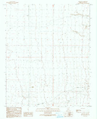
1990 Map of Bouse SW
USGS Topo · Published 1990About this map
Plomosa terrain and the arid expanses of La Paz County define this 1990 provisional survey. The landscape is marked by the presence of mineral exploration, with several prospects and an adit located in the northeastern quadrant, suggesting the area's history of small-scale mining. Transportation across this portion of the Sonoran Desert is anchored by Plomosa Road, which traverses the southern sections and provides the primary corridor through the valley. Aside from a Gravel Pit and scattered tanks used for water storage, the map reveals a largely undeveloped landscape where section lines and township boundaries like T 6 N T 5 N provide the principal structure for land organization.
Find a feature on this map
8 named features on this map. Tap any name to fly to it.
Don’t see what you’re looking for? This feature index may not catch every label — zoom into the map to look around manually.
Map Details
Editions of this 1990 Bouse SW Map
This is the sole edition of this map. No revisions or reprints were ever made.
Other maps of this area

1930 · Linskey
USGS Topo · 1:62,500

1931 · Moon Mtn
USGS Topo · 1:62,500

1932 · Moon Mtn
USGS Topo · 1:62,500

1933 · Cunningham Mtn
USGS Topo · 1:48,000

1940 · Dome Rock Mts
USGS Topo · 1:62,500

1942 · Blythe
USGS Topo · 1:250,000

1942 · MOON MTN
USGS Topo · 1:62,500

1954 · Salton Sea
USGS Topo · 1:250,000

1955 · Salton Sea
USGS Topo · 1:250,000

1959 · Salton Sea
USGS Topo · 1:250,000