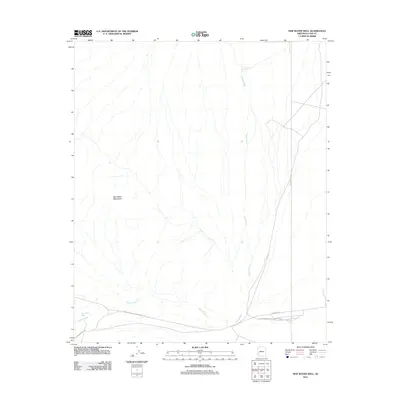
2011 Map of New Water Well
USGS Topo · Published 2011About this map
New Water Mountains dominate this arid landscape in La Paz County, where the topography is defined by the drainage patterns of Alamo Wash. The desert terrain is sparsely populated, centered around the New Water Well settlement. This 2011 survey reveals an environment shaped by utility infrastructure and transit, notably the El Paso Natural Gas Company Ac Rd which traverses the southern portion of the quadrangle. Other key access routes such as Vicksburg Rd and Wilbanks Rd provide the primary connection through the basin, while the isolated Grouder Tank serves as a lone water feature in the northern reaches of the wash system.
Find a feature on this map
7 named features on this map. Tap any name to fly to it.
Don’t see what you’re looking for? This feature index may not catch every label — zoom into the map to look around manually.
Map Details
Editions of this 2011 New Water Well Map
This is the sole edition of this map. No revisions or reprints were ever made.
Other maps of this area

1942 · Vicksburg
USGS Topo · 1:250,000

1954 · Phoenix
USGS Topo · 1:250,000

1957 · Phoenix
USGS Topo · 1:250,000

1958 · Phoenix
USGS Topo · 1:250,000

1960 · Phoenix
USGS Topo · 1:250,000

1961 · Hope
USGS Topo · 1:62,500

1962 · Little Horn Mts
USGS Topo · 1:62,500

1962 · Kofa Butte
USGS Topo · 1:62,500

1962 · Vicksburg
USGS Topo · 1:62,500

1969 · Phoenix
USGS Topo · 1:250,000