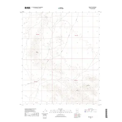
2018 Map of Ibex Peak
USGS Topo · Published 2018About this map
The Plomosa Mountains dominate this high-desert landscape in La Paz County, where topography dictates the few corridors for movement through the arid terrain. The map is centered on the distinct heights of Ibex Peak and Haystack Peak in the southern reaches, while the northern extent is defined by the Four Peaks formation. Human impact is sparse, primarily traced along Plomosa Rd, a primary desert artery that winds through the gaps between mountain ranges. The survey illustrates the stark relief and drainage patterns of a landscape managed by the Bureau of Land Management, where the Public Land Survey System grids—such as t6n r17w and t5n r18w—overlay the natural contours of the Arizona desert.
Find a feature on this map
9 named features on this map. Tap any name to fly to it.
Don’t see what you’re looking for? This feature index may not catch every label — zoom into the map to look around manually.
Map Details
Editions of this 2018 Ibex Peak Map
This is the sole edition of this map. No revisions or reprints were ever made.
Other maps of this area

1930 · Linskey
USGS Topo · 1:62,500

1942 · Blythe
USGS Topo · 1:250,000

1942 · Vicksburg
USGS Topo · 1:250,000

1954 · Salton Sea
USGS Topo · 1:250,000

1954 · Phoenix
USGS Topo · 1:250,000

1955 · Salton Sea
USGS Topo · 1:250,000

1957 · Phoenix
USGS Topo · 1:250,000

1958 · Phoenix
USGS Topo · 1:250,000

1959 · Salton Sea
USGS Topo · 1:250,000

1960 · Phoenix
USGS Topo · 1:250,000