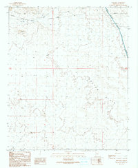
1990 Map of Bobs Well
USGS Topo · Published 1990About this map
Cactus Plain defines the arid character of this La Paz County landscape, where water management and sparse infrastructure are the primary markers of human presence. The northern portion of the quadrangle is dominated by the Osborne Wash, which passes near the small settlement of Osborne and the namesake Bobs Well. This 1990 provisional edition documents the critical water infrastructure of the era, most notably the Hayden-Rhodes Aqueduct cutting through the northeast, accompanied by a Road on Levee and various Gates.
Find a feature on this map
12 named features on this map. Tap any name to fly to it.
Don’t see what you’re looking for? This feature index may not catch every label — zoom into the map to look around manually.
Map Details
Editions of this 1990 Bobs Well Map
This is the sole edition of this map. No revisions or reprints were ever made.
Other maps of this area

1911 · Parker
USGS Topo · 1:125,000

1923 · Signal
USGS Topo · 1:250,000

1930 · Linskey
USGS Topo · 1:62,500

1942 · Signal
USGS Topo · 1:250,000

1942 · Blythe
USGS Topo · 1:250,000

1942 · Vicksburg
USGS Topo · 1:250,000

1950 · Prescott
USGS Topo · 1:250,000

1954 · Salton Sea
USGS Topo · 1:250,000

1954 · Needles
USGS Topo · 1:250,000

1954 · Prescott
USGS Topo · 1:250,000