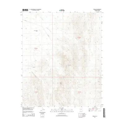
2014 Map of Cibola SE
USGS Topo · Published 2014About this map
Trigo Mountains dominate the eastern landscape of this La Paz County region, rising sharply above the desert floor. The area is defined by its dramatic drainage patterns, where seasonal waters move through Crazy Woman Wash and Gould Wash toward the Great Colorado Valley. To the south, the prominent landmark Needles Eye marks a distinct break in the mountain terrain. This 2014 survey documents the sparse but critical infrastructure of the high desert, including Baseline Rd and Hart Mine Rd, which likely served historical mining interests in the interior. The network of arid watercourses, such as Hart Mine Wash and Lopez Wash, illustrates the topographic character of a landscape where elevation and water access dictated early travel and land use.
Find a feature on this map
13 named features on this map. Tap any name to fly to it.
Don’t see what you’re looking for? This feature index may not catch every label — zoom into the map to look around manually.
Map Details
Editions of this 2014 Cibola SE Map
This is the sole edition of this map. No revisions or reprints were ever made.
Other maps of this area

1934 · Trigo Peaks
USGS Topo · 1:48,000

1939 · Red Hill
USGS Topo · 1:62,500

1939 · Trigo Peaks
USGS Topo · 1:62,500

1942 · Blythe
USGS Topo · 1:250,000

1945 · Cibola
USGS Topo · 1:62,500

1945 · Picacho
USGS Topo · 1:62,500

1951 · Picacho
USGS Topo · 1:62,500

1951 · Cibola
USGS Topo · 1:62,500

1952 · Mule Wash
USGS Topo · 1:24,000

1952 · Palo Verde
USGS Topo · 1:24,000