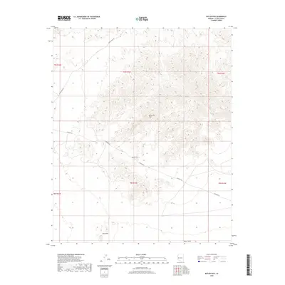
2018 Map of Butler Pass
USGS Topo · Published 2018About this map
Battleship Peak rises as a prominent landmark in this desert landscape within La Paz County, marking the transition between the upland terrain and the broad expanse of the Butler Valley. This 2018 survey illustrates a region defined by its topography and infrastructure, where the Butler Pass serves as a natural corridor through the northern extent of the Bouse Hills. The landscape is largely undeveloped, with human activity primarily defined by utility and transit routes such as Powerline Rd and Lincoln Ranch Rd, which cross the arid flats. This map provides a detailed view of the township and range divisions, including t9n r15w and t8n r15w, revealing the systematic grid used for land management in the Arizona desert.
Find a feature on this map
12 named features on this map. Tap any name to fly to it.
Don’t see what you’re looking for? This feature index may not catch every label — zoom into the map to look around manually.
Map Details
Editions of this 2018 Butler Pass Map
This is the sole edition of this map. No revisions or reprints were ever made.
Other maps of this area

1923 · Signal
USGS Topo · 1:250,000

1942 · Signal
USGS Topo · 1:250,000

1942 · Vicksburg
USGS Topo · 1:250,000

1950 · Prescott
USGS Topo · 1:250,000

1954 · Prescott
USGS Topo · 1:250,000

1954 · Phoenix
USGS Topo · 1:250,000

1957 · Phoenix
USGS Topo · 1:250,000

1958 · Prescott
USGS Topo · 1:250,000

1958 · Phoenix
USGS Topo · 1:250,000

1959 · Prescott
USGS Topo · 1:250,000