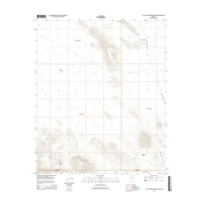
2014 Map of Little Horn Mountains NE
USGS Topo · Published 2014About this map
The Little Horn Mountains rise above the arid expanses of western Arizona in this 2014 survey. The map details the sharp elevation changes of the range as it meets the southern edge of the Ranegras Plain, an area characterized by broad alluvial basins and intermittent drainage patterns. In the southeastern portion of the quadrangle, the land descends into the Nottbusch Valley, illustrating the classic basin-and-range topography of the region. Transportation across this remote landscape is largely defined by the Palomas Harquahala Rd, which skirts the eastern edge of the mountains. The map also delineates the administrative boundary between La Paz Co and Yuma Co, providing a clear record of land divisions within the Public Land Survey System including t2n r13w and t1n r12w.
Find a feature on this map
10 named features on this map. Tap any name to fly to it.
Don’t see what you’re looking for? This feature index may not catch every label — zoom into the map to look around manually.
Map Details
Editions of this 2014 Little Horn Mountains NE Map
This is the sole edition of this map. No revisions or reprints were ever made.
Other maps of this area

1942 · Vicksburg
USGS Topo · 1:250,000

1954 · Phoenix
USGS Topo · 1:250,000

1957 · Phoenix
USGS Topo · 1:250,000

1958 · Phoenix
USGS Topo · 1:250,000

1960 · Phoenix
USGS Topo · 1:250,000

1961 · Hope
USGS Topo · 1:62,500

1961 · Lone Mountain
USGS Topo · 1:62,500

1962 · Little Horn Mts
USGS Topo · 1:62,500

1962 · Eagletail Mts
USGS Topo · 1:62,500

1969 · Phoenix
USGS Topo · 1:250,000