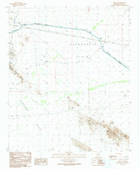
1990 Map of Hope SE
USGS Topo · Published 1990About this map
The Hayden-Rhodes Aqueduct cuts a straight engineered line across the arid expanse of the Harquahala Plain, illustrating the intensive water management required in the Arizona desert by 1990. This landscape is a mix of heavy infrastructure and mineral exploration, featuring a prominent Pipeline and a network of mining activity in the uplands. Prospectors and geologists can trace numerous mine shafts and Prospects scattered through the Little Harquahala Mountains and the Eagletail Mountains, the latter of which also contains a noted Natural Arch. Regional transportation and aviation are represented by Hovatter Road and the landing strips at Salome Field, while the Ranegras Plain occupies the southwest, showing a terrain largely defined by its open flats and intermittent drainage patterns.
Find a feature on this map
19 named features on this map. Tap any name to fly to it.
Don’t see what you’re looking for? This feature index may not catch every label — zoom into the map to look around manually.
Map Details
Editions of this 1990 Hope SE Map
This is the sole edition of this map. No revisions or reprints were ever made.
Other maps of this area

1942 · Vicksburg
USGS Topo · 1:250,000

1954 · Phoenix
USGS Topo · 1:250,000

1957 · Phoenix
USGS Topo · 1:250,000

1958 · Phoenix
USGS Topo · 1:250,000

1960 · Phoenix
USGS Topo · 1:250,000

1961 · Hope
USGS Topo · 1:62,500

1961 · Lone Mountain
USGS Topo · 1:62,500

1962 · Little Horn Mts
USGS Topo · 1:62,500

1962 · Eagletail Mts
USGS Topo · 1:62,500

1969 · Phoenix
USGS Topo · 1:250,000